


 218-326-5573

The Itasca SWCD receives funding through several projects from the Minnesota Pollution Control Agency (MPCA) as part of the Clean Water Fund initiative to collect water quality data as well as civic engagement outreach to the community, and participate in water planning by geographic areas called a major watershed. The state of Minnesota is comprised of 80 major watersheds which are drainage areas based on topography of the landscape. Itasca County has a part of 6 different major watersheds, including; Red Lake, Big Fork River, Little Fork River, St. Louis River, Upper Mississippi River – Headwaters, and the Upper Mississippi River – Grand Rapids.
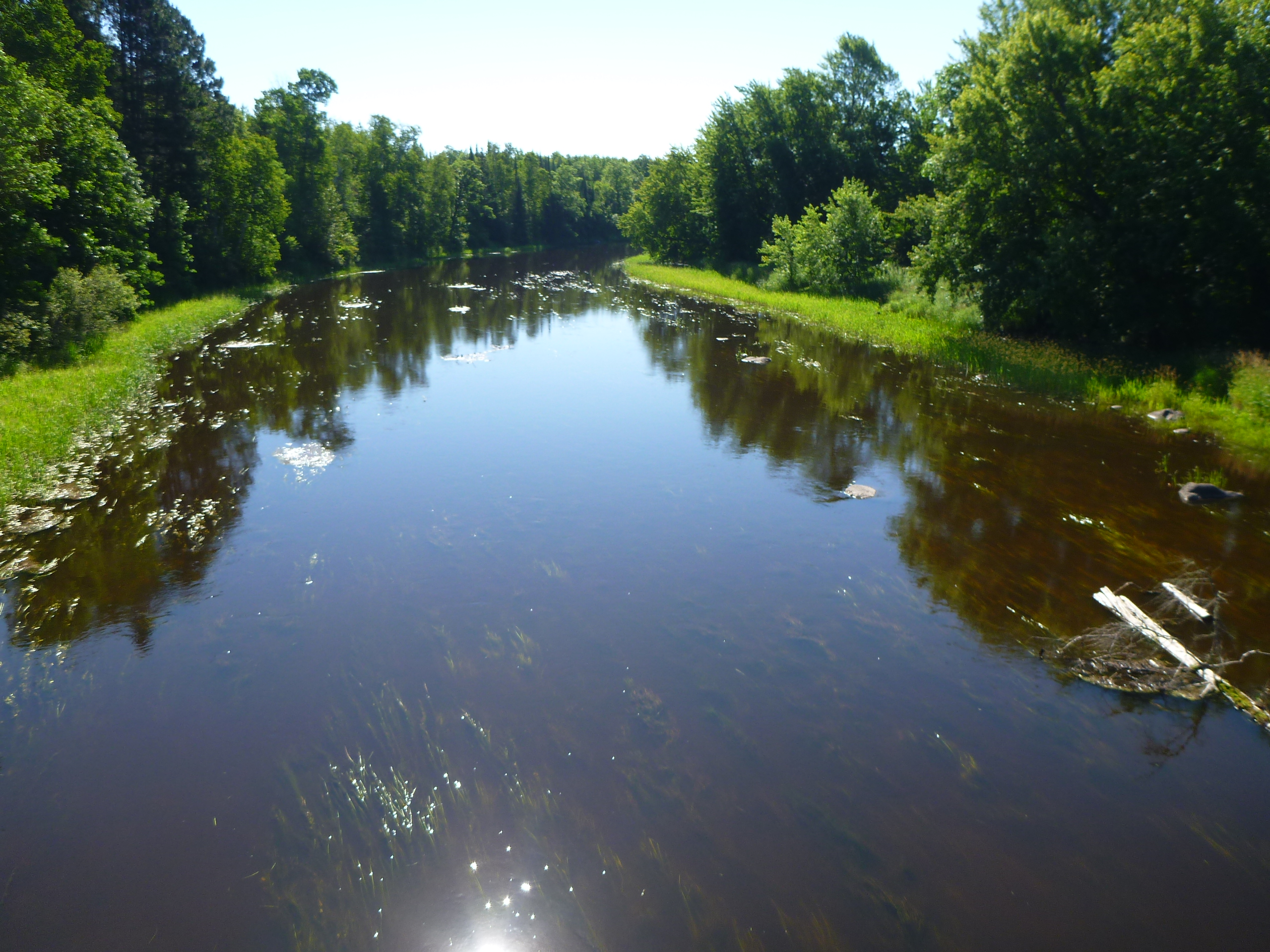
Itasca SWCD is contracted by the MPCA to collect water samples, field parameters, photos, and site observations from Itasca County lakes and streams under the Watershed Pollutant Load Monitoring Network (WPLMN) and Surface Water Assessment Grants (SWAG). Surface Water Assessments are granted for the first two years of Intensive Watershed Monitoring as part of the Watershed Restoration and Protection Strategies (WRAPS) ten-year cycle. Water quality samples are brought to RMB environmental lab located on the Itasca Community College campus for analysis. The data from each sample, along with the other field information is entered into the State of Minnesota’s EQuIS database, where it is used to determine if a waterbody is meeting the State of Minnesota’s water quality standards. The standards are based on waterbody use classified by the MPCA in their Tiered Aquatic Life Uses (TALU) Framework. Most Itasca County waters are classified according to Aquatic Life and Recreational use standards.
These Surface Water Assessment Grants (SWAG) are part of the Intensive Watershed Monitoring phase of a larger ten-year rotating framework for assessing watershed health and working with local partners (SWCD’s amongst others) to gather community stakeholder participation in creating a comprehensive watershed plan for each major watershed. The Intensive Watershed Monitoring (SWAG) occurs within the first two years of the ten-year framework, followed by roughly three years of community conversations, under the Watershed Restoration and Protection Strategies (WRAPS) project. These community conversations provide the community with information as to the current state of our water resource health, as well as providing the public with opportunities to contribute ideas and opinions in real ways to watershed planning.
The Watershed Pollutant Load Monitoring Network (WPLMN) is a long-term water quality monitoring program designed to measure and compare pollutant load information from Minnesota’s rivers to track water quality trends through time. Data collected are used in assessing impaired waters, watershed modeling, determining pollutant source contributions, developing watershed and water quality reports, and measuring the effectiveness of water quality restoration efforts. Itasca SWCD began monitoring one sub-watershed site on the Big Fork River in 2013. In 2018, Itasca SWCD also began monitoring for a second site on the Big Fork River downstream from the primary site, located near Craigsville just across the border into Koochiching County.
The Watershed Restoration and Protection Strategies (WRAPS) grant project for each major watershed is where the community members and any interested person or entity can come together to learn about the current health of the water systems within each major watershed, and take an active role in helping to shape the planning process for each watershed for the remainder of the ten-year cycle. Planning and prioritization help to clarify where money spent on protection and restoration projects would be most beneficial and effective to achieve conservation that benefits the physical landscape, water resources, habitat, while also providing benefits to the people of Itasca County. In the scope of community engagement, the general concept is to inform, involve, and empower the watershed residents, communities, and civic leaders to protect and restore water resources through thoughtful planning. The product of these projects is to create a watershed plan, which is called the WRAPS document for each major watershed, which also encompasses any Total Maximum Daily Load (TMDL) report created as the result of new water body impairments.
With funding from BWSR Accelerated Implementation Grant, Itasca Soil and Water was able to conduct water quality inventories for 2 years on area lakes in 2015 & 2016.
Accelerated Implementation Lake Reports
Volunteer water clarity monitoring is easy and fun! The Citizen Lake Monitoring Program (CLMP) and the Citizen Stream Monitoring Program (CSMP) are cooperative programs that coordinate the efforts of citizen monitoring volunteers with the data needs of the MPCA, which contribute to assessing, planning, and managing watershed health. Water clarity data, coupled with site observations collected by lake and stream volunteers are used to better understand the current and evolving condition of the state’s water resources. Volunteer contributions to the datasets are used to assess watershed health and guide the restoration and protection strategies planning process. All monitoring equipment is provided by the MPCA, and no prior experience or training is necessary. To become a valued water resources volunteer and contribute to the watershed health planning process in a tangible and meaningful way, check out the map for available lake and stream sites and submit an enrollment form:
Map of CLMP & CSMP Locations
Lake Enrollment Form
Stream Enrollment Form
The MN Department of Health (MDH) is the primary agency responsible for groundwater protection, and safe consumption of water from wells. Groundwater is a resource which few people consider in day to day interactions, yet in Itasca County many residents, communities, and businesses depend on well water. What happens on the landscape can have a long-lasting impact on the groundwater, and contamination can be permanent once it reaches an aquifer.
If you are interested in learning more about your well water, please contact RMB Environmental Labs for information on testing. The laboratory professionals at the RMB Lab on the Itasca Community College campus can help you identify what kind of samples might best answer your questions and concerns.
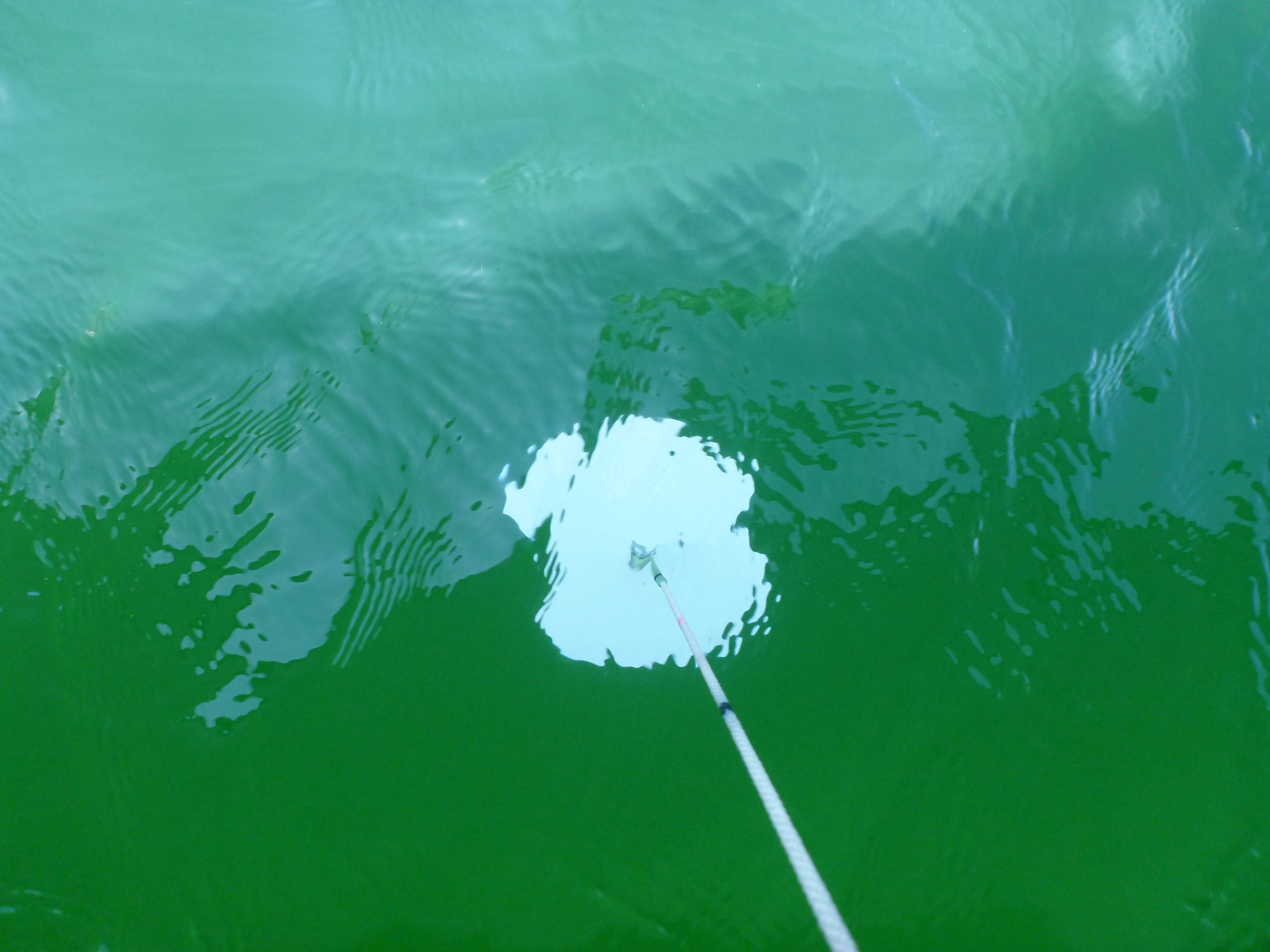
Blue-green algae is a form of bacteria, called Cyanobacteria, which can produce toxins and adversely impact the health of animals and humans that come into contact with them. It can be somewhat hard to distinguish the difference between algae and this bacteria at first glance, but there are some simple tests (jar test and stick test) that you can do to determine if the pigments in your water are potentially toxic. Generally, these blooms occur in late summer when conditions are warm and calm in nutrient rich shallow waters. They resemble a paint slick and are thick in appearance. If a harmful blue-green algae bloom is suspected, avoid contact, and keep pets away from the water. If contact occurs, rinse with clean water immediately. If a pet has been exposed and begins to display unusual symptoms after exposure, contact your veterinarian immediately, as exposure for pets can result in death. Likewise, if an adult or child ingest or have contact with toxins, contact your doctor immediately if symptoms develop such as; vomiting, diarrhea, rash, cough, sore throat, or eye irritation. If in doubt, Stay Out!
The MN Pollution Control Agency,as well as the MN Department of Natural Resources, and MN Department of Health all have an interest in the potential occurrence of a harmful Blue-Green algae bloom in public waters. These agencies have developed an interagency work group dedicated to learning more about this growing issue in Minnesota waters.
The Minnesota Board of Water and Soil Resources (BWSR) oversees County Local Water Management Planning State wide. Counties are ultimately responsible, but the Itasca County Board of Commissioners has delegated the management and implementation of the County Water Management Plan to the Itasca SWCD. The plan outlines County wide goals, objectives, and action items, for a ten-year period, to achieve the surface and ground water resource goals of the County. The current plan, which originally expired in 2017, has been extended until March 31st 2022. The extension was granted by BWSR, in order to allow time for completion and water plan incorporation of the Minnesota Pollution Control Agency (MPCA) Watershed Restoration and Protection Strategies (WRAPS) reports for the four primary Itasca County watersheds. One condition of this extension is an amendment of the plan’s Executive Summary, Goals, Objectives, and Action Items, to be completed by December 31, 2018. Click here for the current “2022-2027 Itasca County Local Water Management Plan”.
The County Board of Commissioners appoints twelve “Water Plan Implementation Committee” (WPIC) members to assist the Itasca SWCD Board of elected Supervisors, in managing and implementing the Local Water Management Plan. Click here for a list of positions and representatives.
Water Quality and Septic Systems