

 218-326-5573
Big Fork River
One Watershed, One Plan
The Big Fork River Watershed has begun the Comprehensive Watershed Planning Process. This will identify priority areas in the watershed to implement voluntary practices to improve water quality in the watershed. To learn more about the watershed planning process, see our Big Fork River 1W1P website.
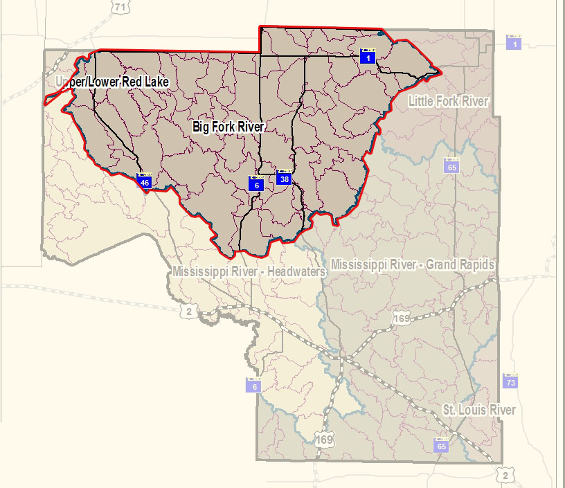
The Big Fork River watershed, which covers 1,326,947 acres, flows 165 miles from Dora Lake (45 miles northeast of Bemidji in north-central Itasca County) to the Rainy River, which forms the Minnesota/Canadian border. This confluence is 16 miles west-southwest of International Falls. Nearly 60% of the watershed is land owned or managed by the state.
Characteristics
Development pressure is moderate in most areas, with occasional farms being parceled out for development, recreation, or country homes. Soil content in the watershed varies from sand to clay glacial till, while low bog areas consist of loam over clay soils. The watershed is mostly low relief with an elevation change of about 375 feet from the headwaters to the confluence at the Rainy River. There are approximately 113 tributary streams that flow into the Big Fork River, though many are seasonal or intermittent that are present during the heavy spring runoff.
What's being done
The Big Fork River watershed is currently in its WRAPS (watershed restoration and protection strategies) Cycle II starting in 2018. Starting in 2020, a Surface Water Assessment Grant (SWAG) was provided to collect water samples from 23 lakes in theBig Fork watershed within Itasca County. Results from this study will help determine the health of the watershed and identify any possible lakes that may need restoration or protection to improve water quality. In previous monitoring, Jessie and Island lake were identified as impaired waterbodies due to excessive nutrients in the lake- current research is underway to help identify possible sources and protect the water quality of these lakes. The Watershed Pollutant Load Monitoring Network (WPLMN) measures and compares data on pollutant loads from Minnesota’s rivers and streams and tracks water quality trends. Water pollution load monitoring is currently being completed on the Big Fork River to find how much and what type of runoff pollution ends up in the Big Fork River following rain events. This helps identify if the water quality is improving, helps identify what pollutants are in the river and try to reduce them.