

 218-326-5573
Upper Mississippi River - Headwaters
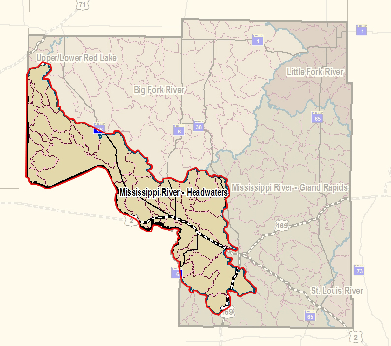
The Mississippi River - Headwaters watershed consists of 1,255,105 acres (1,961 square miles) in the far north part of the basin. The watershed contains the headwaters of the Mississippi River at Lake Itasca in Itasca State Park. The watershed includes parts of Becker, Beltrami, Cass, Clearwater, Hubbard and Itasca counties.
The Mississippi River — Headwaters watershed has approximately 685.05 river miles (NHDPlus - 1:100k source scale, flowline layer) and contains more than 1,000 lakes with a total acreage of 180,375.
The Mississippi River - Headwaters watershed is a largely forested watershed located in the Northern Lakes and Forest ecoregion of Minnesota. As the Mississippi River begins its 2,320-mile journey to the Gulf of Mexico, it runs north to north easterly through the watershed’s abundant forest resources and large riverine wetland areas. The forest resources are a vital component to the economy of the area and provide habitat for a variety of wildlife species.
Approximately 44% of the land in this watershed is privately owned, with the remaining portion of land state, county or federal public land, or held by tribal land owners. Agricultural land use within the watershed is moderate, accounting for approximately 10% of the available acres.
Groundwater springs are present throughout much of the river channel throughout this watershed. These springs are especially common above Lake Bemidji where groundwater contributes approximately two-thirds of the Mississippi River’s flow in this section.
This watershed is rich in surface water resources, including some of Minnesota’s most famous lakes and streams. Each year, thousands of anglers travel to this watershed in search of walleye and other game fish.
Currently, the vast majority of the surface water resources within this watershed meet Minnesota’s surface water quality standards for conventional parameter pollutants (not including mercury). However, these resources continue to experience increased pressure from development and subsequent loss of shoreline and aquatic habitat. The threat of aquatic invasive species is also a primary concern for local partner groups, conservation groups, and the citizens within this watershed.
The major threats to the watershed include:
- Loss of shoreline and aquatic habitat due to development. Many of the prime lakeshore properties have been developed with the focus of development turning toward more marginal shoreland and/or shoreland along smaller natural environmental water resources.
- Increased sedimentation due to forest management practices.
- Increased nutrient, contaminant, and sedimentation loading from stormwater runoff from development and other non-point sources.
- Loss of biodiversity due to competition from invasive species.
The Upper Mississippi Headwaters Watershed is currently in the One Watershed, One Plan process.You can find more information at https://headwatershed.org/.